March 31, 2024; West End, Bahamas, to Stuart, Florida; Today’s run: 130 miles
One hundred and thirty miles was the most miles we had travelled non-stop, but the weather and sea conditions were good, and we had a comfortable ride.
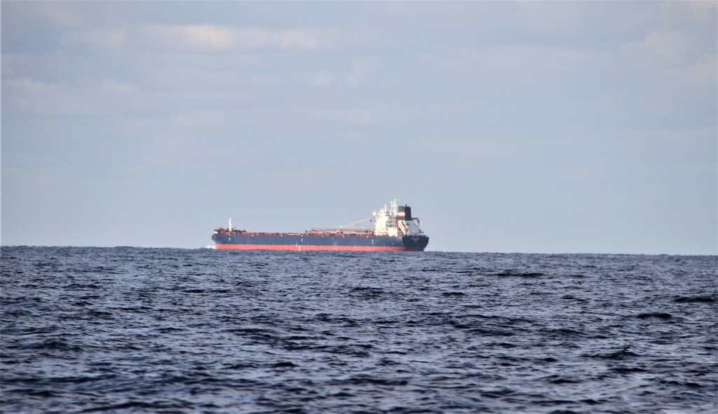

A second ship runs south along the edge of the Gulf Stream, staying out of the opposing current.

Fort Pierce Inlet* is a popular entry point for boaters to make landfall from West End, Bahamas. An alternate arrival point is nearer Stuart, at the St. Luci Inlet, (The Crossroads). But St. Lucie is known for shifting sands, tidal currents, and rough sea conditions. “The St. Lucie Inlet has a reputation for being one of the most treacherous in Florida.”((Florida Oceanographic society.)
Fort Pierce was formerly a headquarters and military post for the Army of the South during the Second Seminole War (1835-’42).
*Fort Pierce Inlet, formerly a natural ingress through the barrier islands, was used by ships to deliver supplies during the war. From there, supplies were loaded onto horse-drawn wagons and transported to other forts and posts including those located around Lake Okeechobee.
Dredging the Inlet in the early 1920s, provided a safety-factor for larger commercial vessels arriving from the Atlantic Ocean. During the ’30s, cargo ships, including shipments of Indian River grapefruit, frequently used the Indian River Inlet.
Grapefruit: Why do we have to pay so much for Florida-grown grapefruit? That was a question I often pondered knowing that in past years I had paid so much less for the juicy fruit.
Fort Pierce, (population: 50,000), is the centre of Florida’s Indian River citrus industry. The citrus growing region, a 200mi/322km long strip, stretches down the east coast of Florida from Daytona Beach to West Palm Beach. Here, conditions are perfect for growing the highly-sweet citrus fruit: high calcific soil, high humidity, and a high water table. Citrus is a multi-billion-dollar worldwide industry with commercial productions in Brazil, the European Union, the U.S. and in China which produces 70% of the world’s fresh grapefruit; Mexico is the second highest producer at 7%, and the U.S. – 6% . Until recently, (2021), Florida was the largest citrus producer in the U.S. However, Florida’s citrus industry is currently threatened by the disease, huanglongbing (HLB – citrus greening). HLB has decimated millions of trees and thereby reduced Florida’s industry to a fraction of what it was. (Indian River Grapefruit Production in the Age of Huanglongbing: Current Status, Challenges and Opportunities, 2022.)
But there is more. In October 2024, hurricane Milton slammed into central and SW Florida. It, along with past hurricanes, have had significant impacts on the industry. It is possible, that this year’s production, (2025), will be 33% lower than in 2024. “If that prediction is accurate, Florida will experience the lowest production of citrus in more than a century”, ( Florida Weekly). It is not just grapefruit that has been affected but also oranges, tangerines, and other citrus fruits.
We did not stop in Fort Pierce but headed south on the Intracoastal Waterway, (ICW)/Indian River, towards Stuart. (see above chart).
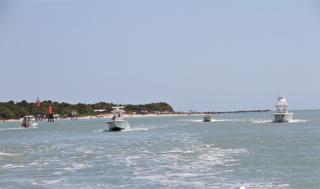
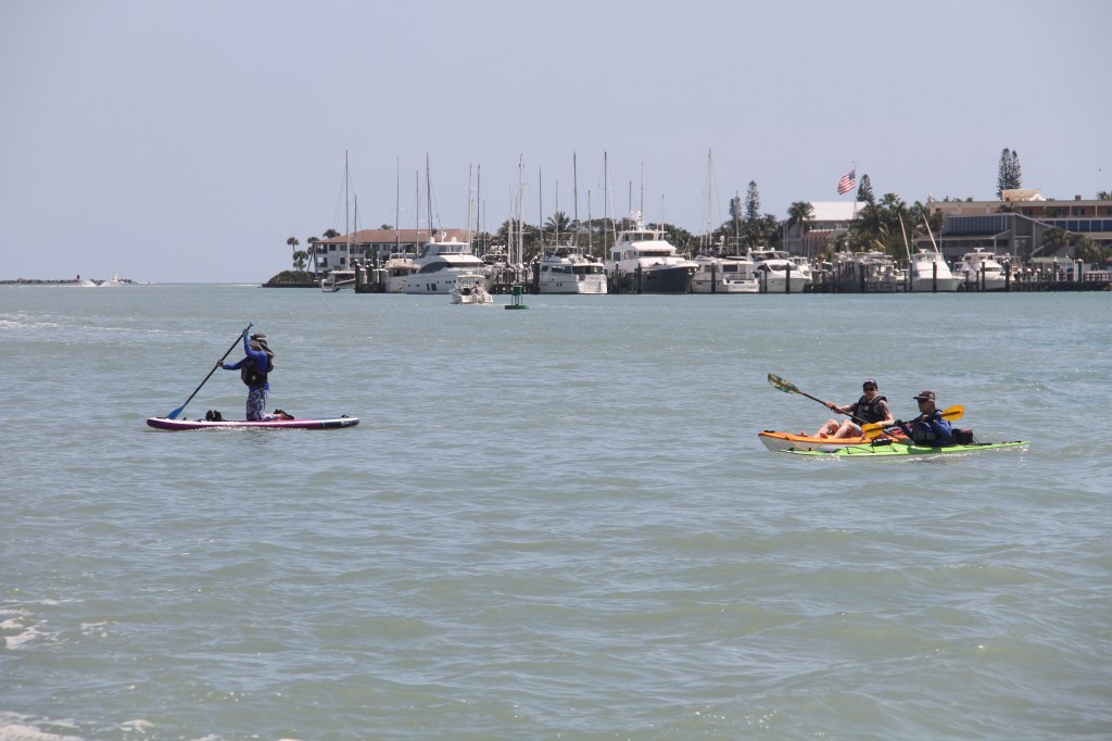
Arriving to where the St Lucie River meets the ICW, we needed to execute a starboard turn, (west towards Stuart), off the ICW, (mile 988), into the St Lucie River*/Okeechobee Waterway. We could barely see the buoys marking the entry to the river from all the activity taking place at the turn, a 4-way junction nicknamed The Crossroads. The junction, ( Mile Zero on the Okeechobee Waterway), consists of the north and southbound ICW lanes, the entrance to St Lucie Inlet (from the Atlantic Ocean ), and the upstream-running St Lucie River. It was like driving a car into the busiest city intersection without traffic lights and without adhering to rules of the road! Boats criss-crossed, merged, and overtook while heading to their destinations, the most confident with throttles pressed fully forward. The result was a frothy, turbulent, white-water mix kicked up by tides, currents and churning propellers, to the point it resembled a series of thundering rapids. “This is not an area known for boat etiquette” states Waterway Guide.
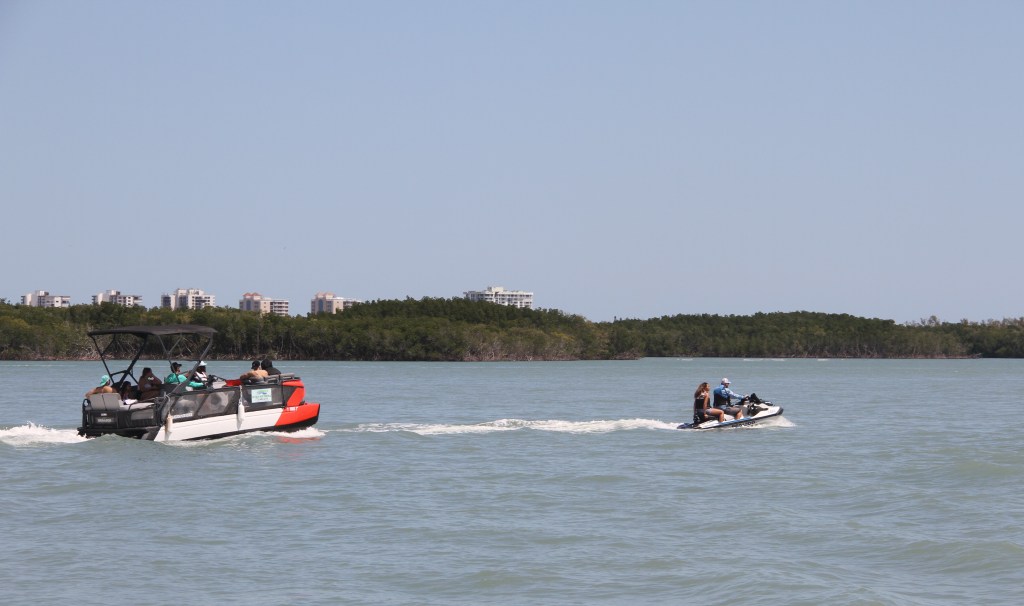
Turning onto the river, we were surrounded by more highspeed boaters, jet skis racing after each other, paddle boarders unconscious of the dangers of moving vessels, and others not having a clew about safe-boat handling. It was like we had landed on another planet, and I guess we had; it was a world away from the peaceful Bahama Islands.
**The St Lucie River becomes the Okeechobee Waterway, a manmade channel cutting across central Florida and ending in Fort Meyers.
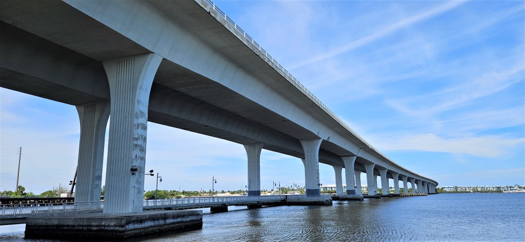
To get to Stuart from the NE, we needed to pass beneath 3 bridges within 800 feet/244 metres of each other. The first bridge is the Roosevelt Bridge. With a clearance of 65 ft., it was designed for most boats to pass underneath it.
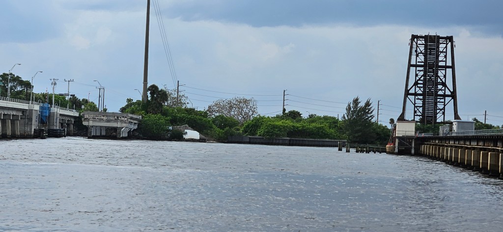
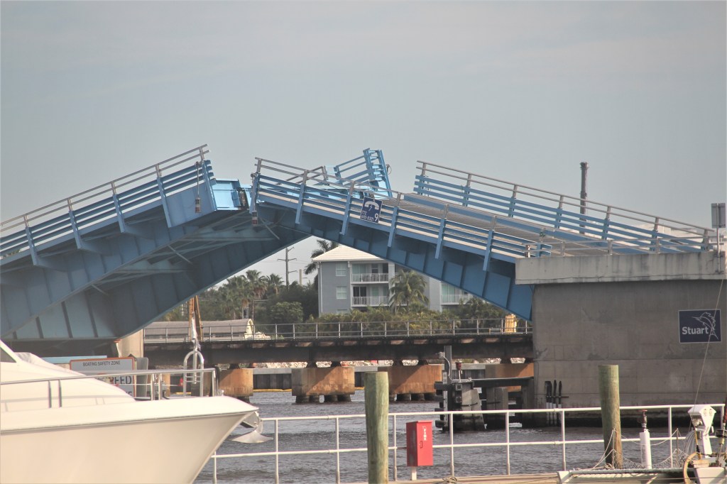
The Florida East Coast Railroad Bridge, with a 7-foot closed vertical is usually open unless a train is coming. Unmanned, the bridge has no schedule but closes 10-15 minutes before a train arrives. It also works in concert with the highway bridge, (above, painted blue). At least that is what official reports say; and it opens on demand, (when there are no trains arriving). If you think this is confusing, you’re right.
There is little room to maneuver after passing beneath the 65-foot vertical Roosevelt (US 1) Bridge, but this is where boaters gather to await the opening of the next two bridges. After a train passes, a second train might follow. Boaters can easily spend 30 minutes in a constant state of alertness while maintaining safe distances from each other in the current-riddled river. (picture below).
When we arrived, we joined 3 other boats waiting between the bridges, and then 2 more arrived and then another and another. When there was no more room, boats lined up underneath the Roosevelt Bridge and when that was full, they gathered on the other side of the bridge. It was a weekend, the weather was good and something similar was taking place on the other side of the bridges. They were the ones we would meet underneath the bridges passing in the opposite direction in a space measuring approximately 50 feet/15metres.
We knew the vertical heights of the two bridges before approaching, and we would need to wait for both bridges to open. But they worked in concert, so the information stated, so we were not worried. Truthfully, we are always concerned when navigating in close quarters.
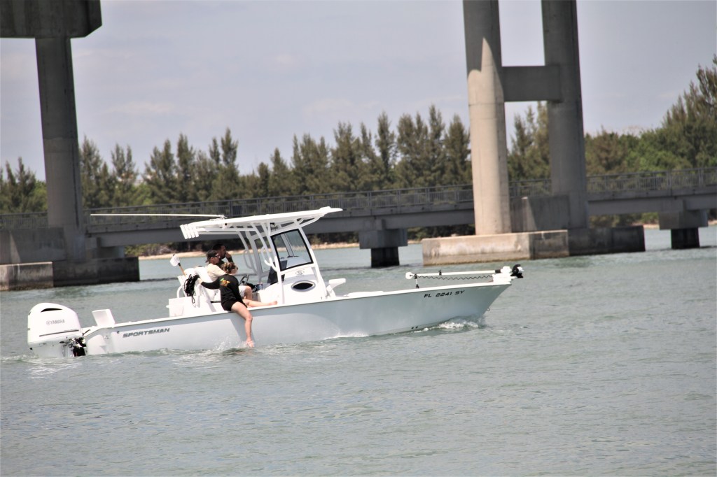
While waiting, I took the boat out of the line-up and off to the side where I thought it might be safer than to juggle in close quarters in a healthy current with several boats. There was only one Boston Whaler over there and overall, it looked like a safer place to be.
There were two young adults on the Boston Whaler. The young woman was lying semi recumbent, leaning on her elbow reclined across the stern. She was conversing with the young man at the helm.
Engrossed with his sensual-looking passenger, he manned the boat with his back to his dashboard, his hands on the controls behind him.
“This could be a problem”, I thought.
Cleopatra then raises from her, ‘I’m-all-yours’ position, leans over the bench that was separating them, and kisses the young man on the mouth; a long romantic kiss!
“Oh, oh, this is not good.” I reiterate.
She then walks slowly around the bench to where the dude is standing; puts her arms around his neck and presses her body up against his. Lover- Boy frees up one of his hands and wraps his arm around her waist. Another long smooch!
I am not making this up.
One thing is for sure, I’m the only one keeping an eye on where either of us is going.
While this love scene plays out, we hear another boater request a bridge opening. His request is followed by a sequence of sirens announcing that the bridge was about to open.
I remained on high alert keeping distance between us and Raging Hormones, moving this way and that, attempting to predict where the Whaler would be in a minute’s time. If we hadn’t been flying a foreign ensign, I think I might have shouted “I’m a friend of your mothers!” If they bought that, maybe they would save it for later.
In addition, I was wondering how we were going to add ourselves to the sloppy line of boats that were waiting for the bridge opening. Once the bridge opened, the boats would charge towards the open bridge. But we were on the wrong side of the line! In fact, once the bridge opened, we would need to cut across the NE lane and join the SW lane of traffic.
The bridge siren squealed its announcement and lifted. I eased the boat towards the lineups, but boats were coming from both directions now, all under pressure to not let the river current pull them towards the bridge abutments. No one slowed to let us in, but instead, keen on keeping ahead of the boat behind them, concentrating on jetting through the passage before the bridge closed again putting some distance between them and everyone else. It appeared to be a bit of a madhouse.
How am I going to cross the lineup of NE boats and get behind the southeast bounders? It’s not like any of us have brakes.
But then a young fellow in a small centre-cockpit saw an opportunity for us to join his line, and he waved us in front of him.
“Thank you, thank you”, I said under my breath.
If I boot it, I thought, I can cut across the NE lane without hitting anyone. But the feat was not a simple one because bursting across, I had to make an immediate port turn to get into the line.
I did it. And neither one of us experienced whiplash.
We were metres from the two bridges when we noticed the railroad bridge had opened but the highway bridge had not. (What happened to working in concert? ) Boats with much lower air draft than ours, were charging through the 50 foot/15m-wide opening. Mike frantically calls out, “CLEARANCE IS 8 FEET! (We need 13.3 ft.)
The only way to keep the roof on the boat was to bail from the lineup. “ANYONE ON MY PORT?” I shouted.
I made a quick turn out of the line-up, crossed the northbound lane in front of an oncoming boat and while steering straight at a fisherman in a runabout, narrowly missed hitting our stern on the bridge abutment. As frantic as the situation was, the fisherman’s presence calmed me. He looked so peaceful with a rod in his hand . (I’m not so sure the fisherman would have had the same thought).
When we heard a siren announce the highway bridge was opening, I had to cross the NE lane again to get back into the SW lane!
The Waterway Guide, states: “Passage through the two bridges can be tricky”. No kidding!
Since navigating those bridges in 2024, the United States Coast Guard has announced new bridge schedules to help boaters avoid confusion. Thank goodness for that! We had to navigate the bridges one more time to return to the ICW and then again twice more the following year.
From Sunset Marina: ($4.50/ft + $30 for power), we could walk along the river into the town of Stuart, population 20,000.


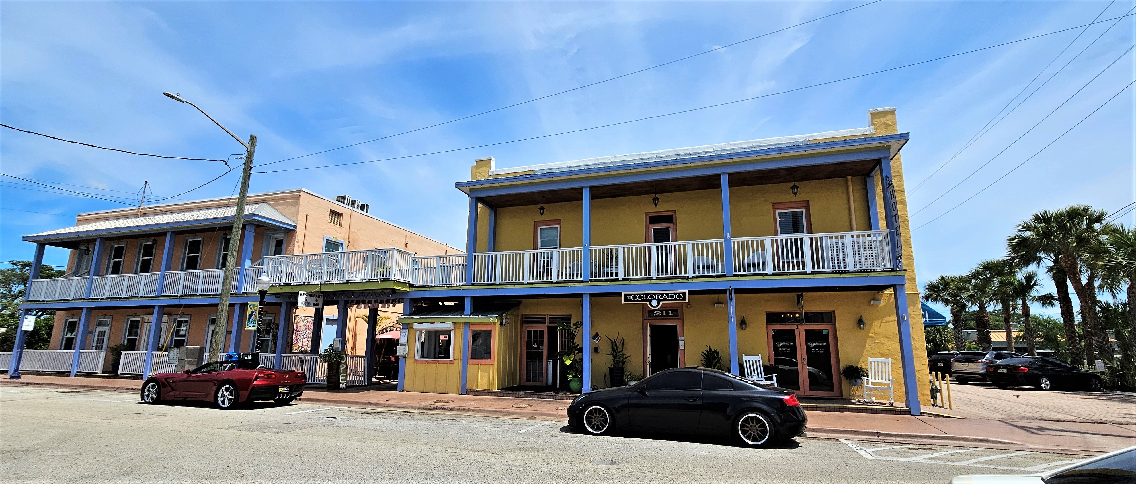
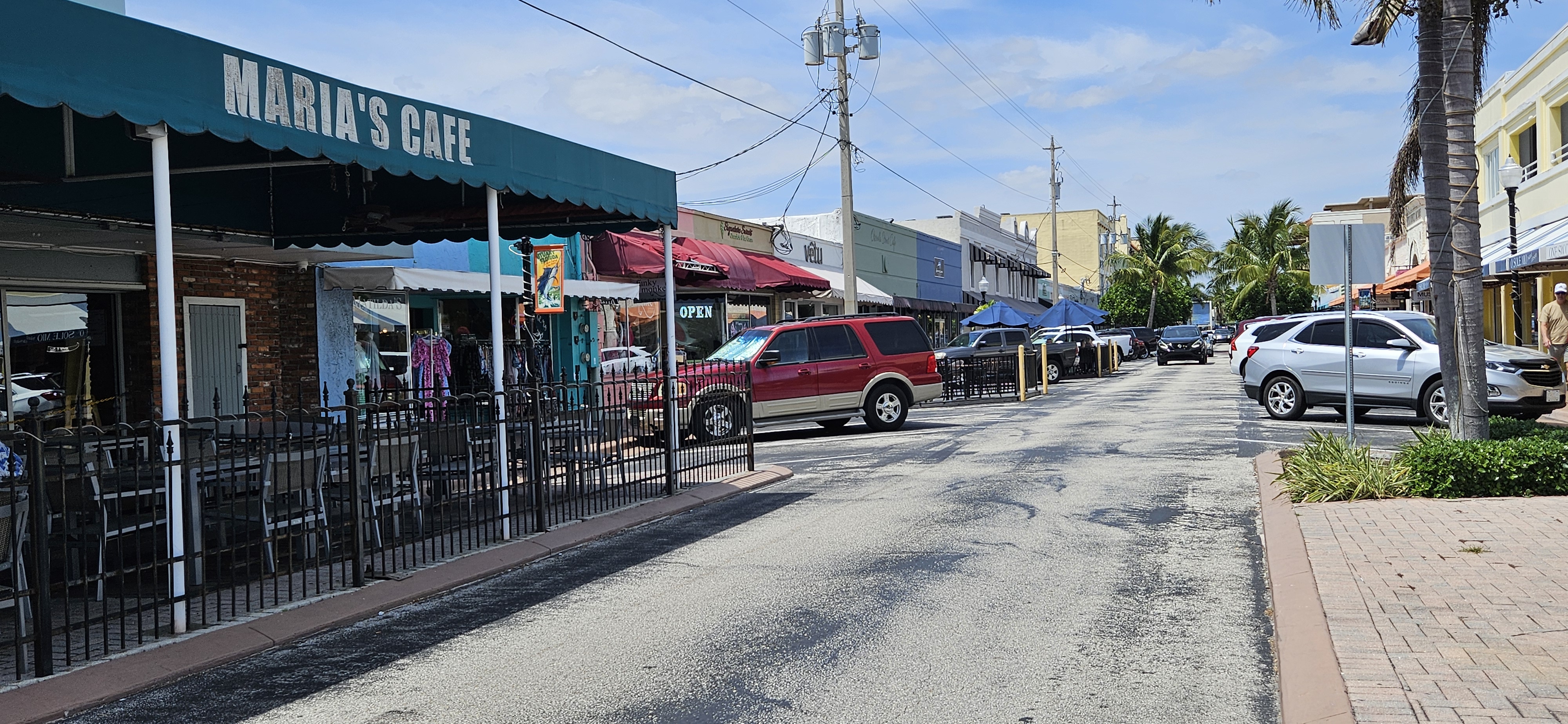
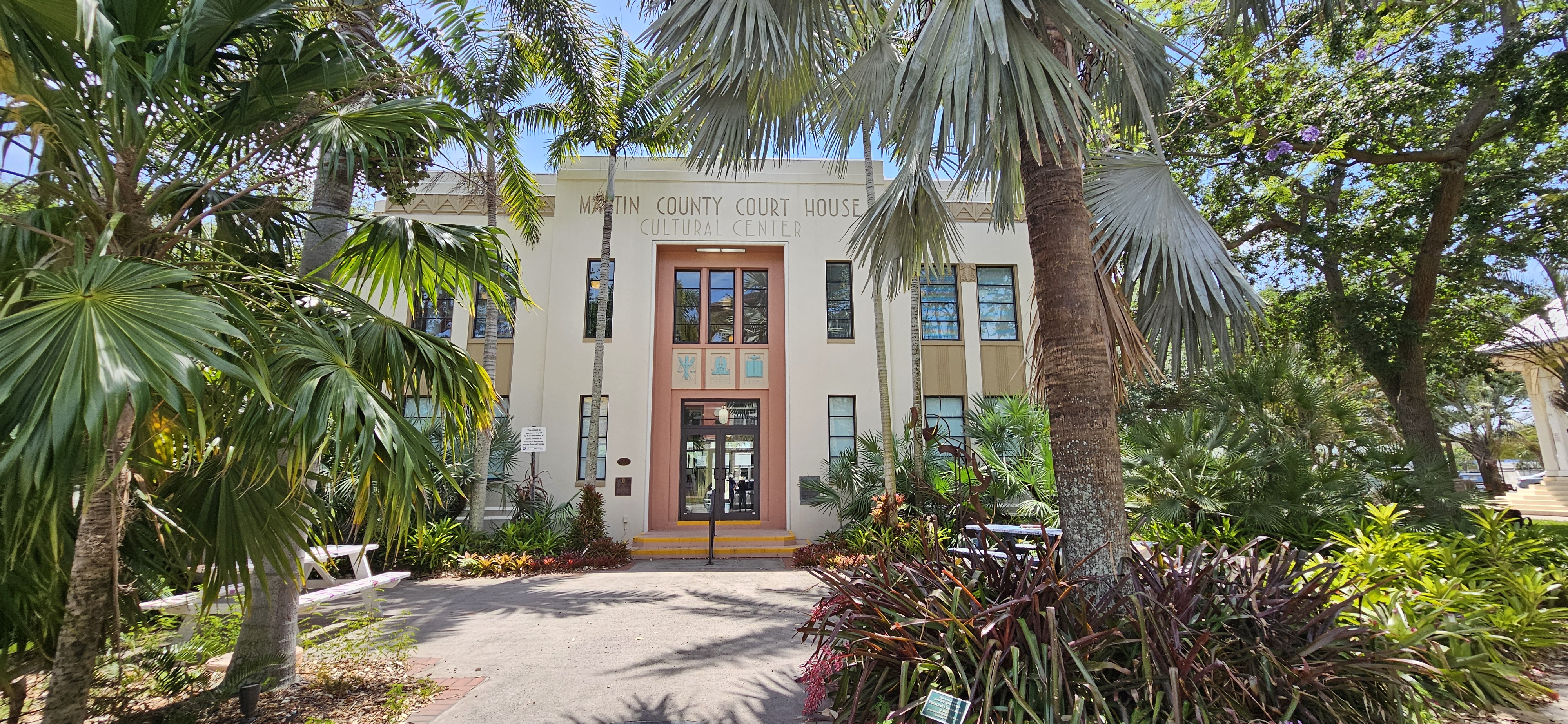
It was a pretty quiet little town when we were there. But we would return in a few months time and find it to be a hopping little tourist town.

Leave a comment