Join us as we travel North America's rivers, waterways, and canals; visit U.S. and Canadian cities, historical landmarks, national parks and river towns. We may even take you to the Bahamas.
Pennekamp Coral Reef State Park, Largo Sound, Key Largo, Florida
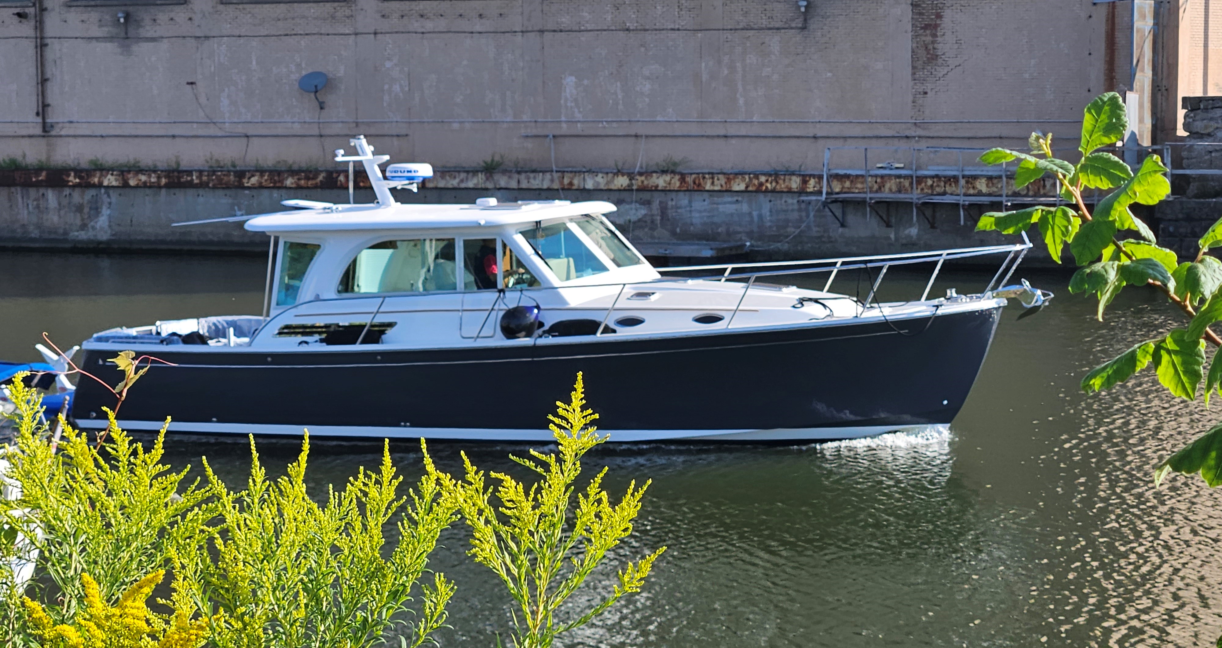
Jan 8-13, 2025; Key West to Pennekamp Coral Reef State Park. Today’s run: 109 miles/6 hrs.
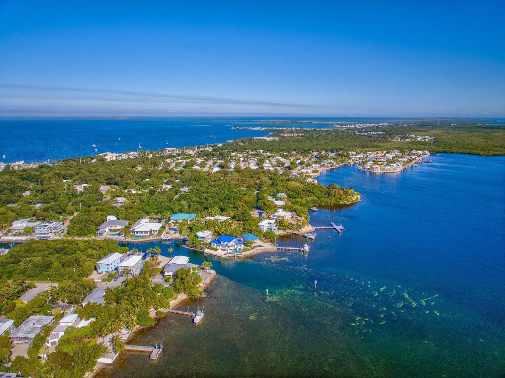
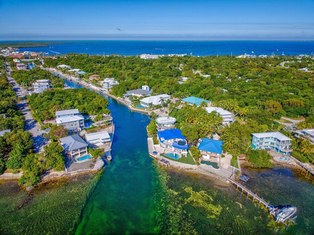
‘Key Largo’, in Spanish ‘Cayo Largo’ – Long Key, is the longest island in the Florida Keys. Population 12, 500, including 12,000 permanent residents. (Picture courtesy of Conley Sales Group).
ENROUTE:
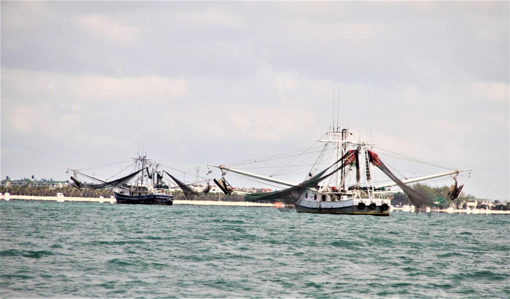
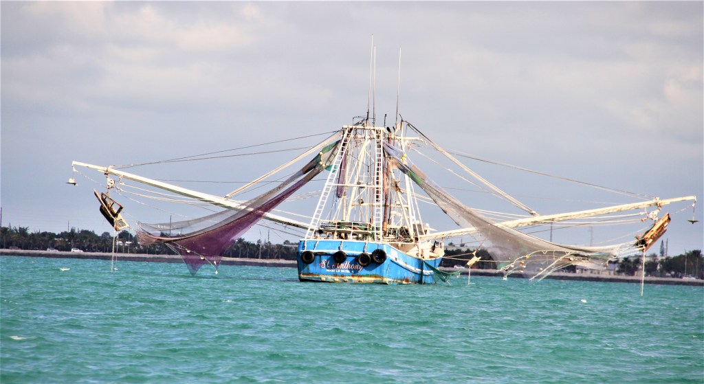
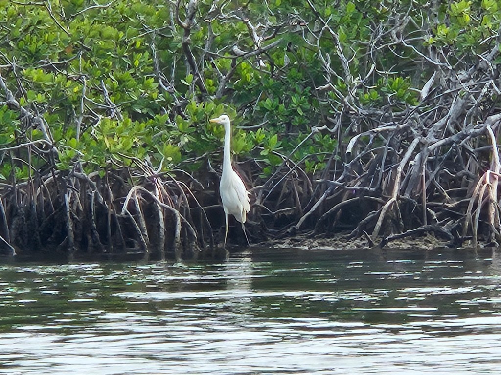
These shrimpers drying their nets, will wait until after dark before trawling for shrimp. Shrimp are more active after dark and with the use of spot-lights, they are attracted towards the nets.
When shrimping in the Gulf of Mexico, shrimpers drag ‘tickler’ chains attached to their bows that stir up crustaceans borrowed in the seabed. Large extended nets, like the ones shown above, sweep through waters inches above the ocean floor. Numerous other marine life, (bycatch), are also caught in the nets. After sorting, the bycatch is thrown back. Fish species such as bonita, cobia and kingfish are attracted to the bycatch making the areas attractive to recreational fishermen. (Disturbing bottom dwelling shrimp with tickler chains, allows for net-dragging above the ocean floor thereby capturing less bycatch.)
Named for John D. Pennekamp, a Miami newspaper editor, who spearheaded the preservation of the Everglades* and helped save a portion of the only living coral reef anywhere in the United States – Pennekamp Reef.** Located north of Key Largo, the underwater park extends approximately 25 mi/40km long. The land portion of the park consists of approximately 170 acres.
*It had taken years to establish the Everglades National Park, Several interested parties had opposed the idea; it would require funding to establish, and the park would take up areas that had potential to be developed.
The original idea had been suggested in 1922 by the Florida Society of Natural History and again in 1928 and again in 1930. In 1934, Congress authorized the area to be the first National Park in the U.S. to protect an ecological system. The boundaries were to include swampland extending across the Tamiami trail to west of Miami, (which at the time was marsh), and to Key Largo, as far out as the reef.
The project did not move forward until 1946 when J Pennakamp reactivated the Everglades National commission, raised the necessary funds to support the project, and moved the boundaries to satisfy most interested parties.
**The Pennekamp state park reef is part of a 270 km /168 mi coral reef extending from east of Soldier Key to south of the Marquesas Keys. The reef is between 5000-7000 years old.
***************
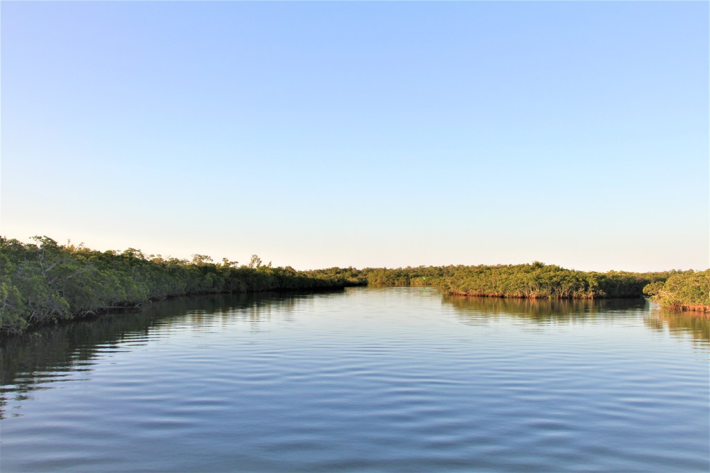
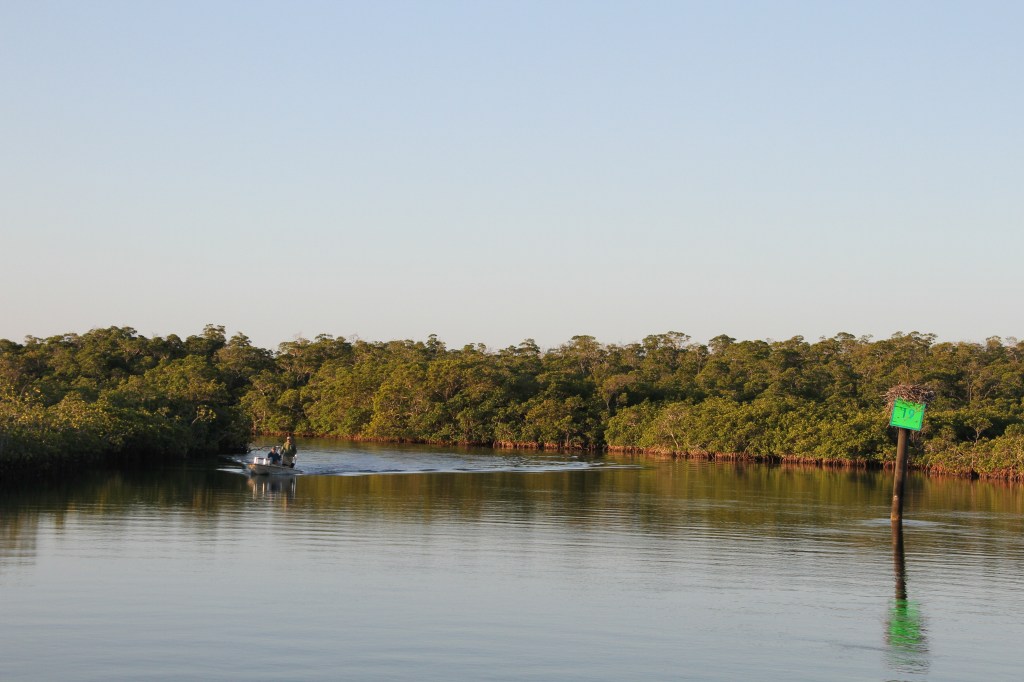
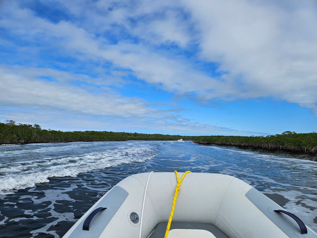
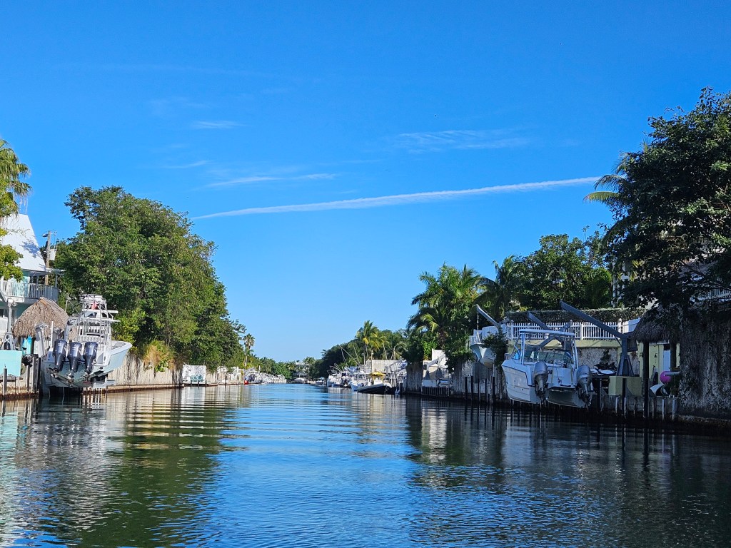
To access Pennekamp Park, we turned off Hawk Channel onto South Creek winding around islets and forests of mangrove trees. The entrance is almost undetectable.The bends are sharp, and we needed to keep to the centre of the channel to avoid hitting the hard-coral rock bordering the creek.*
*During Hurricane Donna, (1960), local boaters were unable to find safe refuge for their boats. In an attempt to provide shelter from future storms, the Army Corp of Engineers, widened and deepened the channels in South Creek. These channels now provide necessary shelter plus a way for boaters to reach the Pennekamp Coral Reef State Park by water.
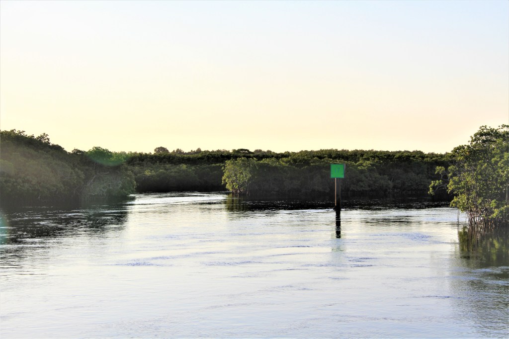
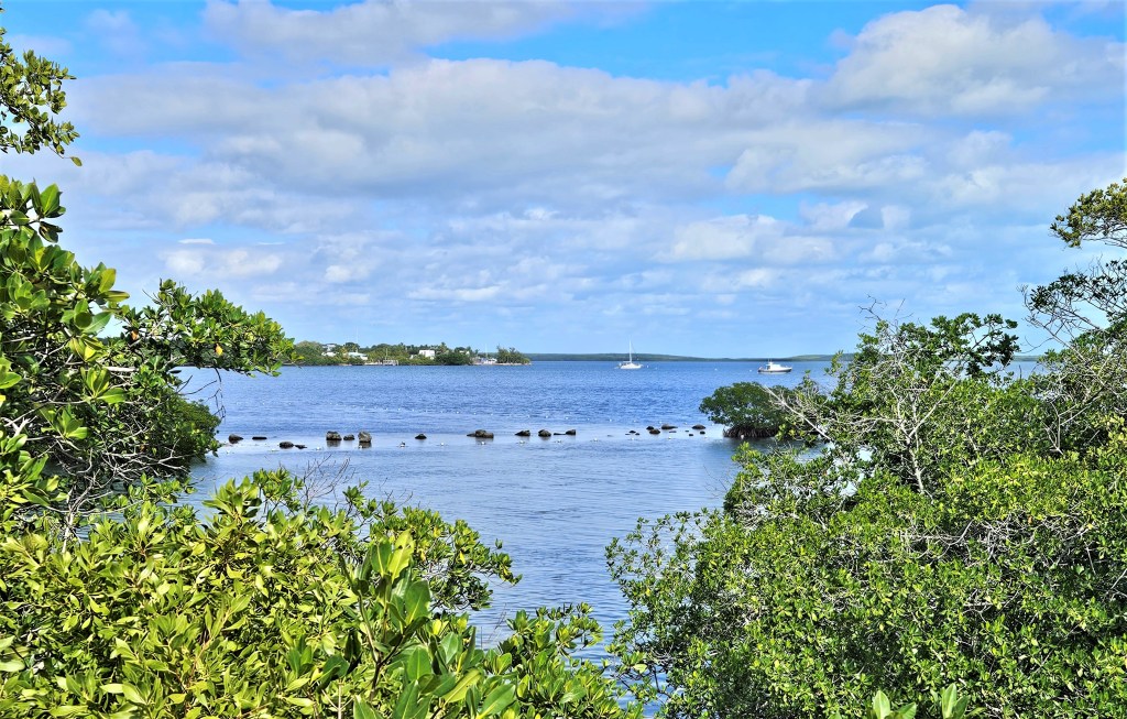
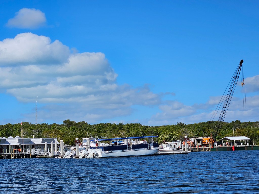
The riverway leads to a large open sound.Largo Sound reaches almost 2 miles long. When we arrived, no other boats were there. A day later, a second boat arrived but stayed no longer the 24 hours. Numerous mooring buoys are available indicating that sometimes the Sound might get pretty busy.
We dinghied to shore
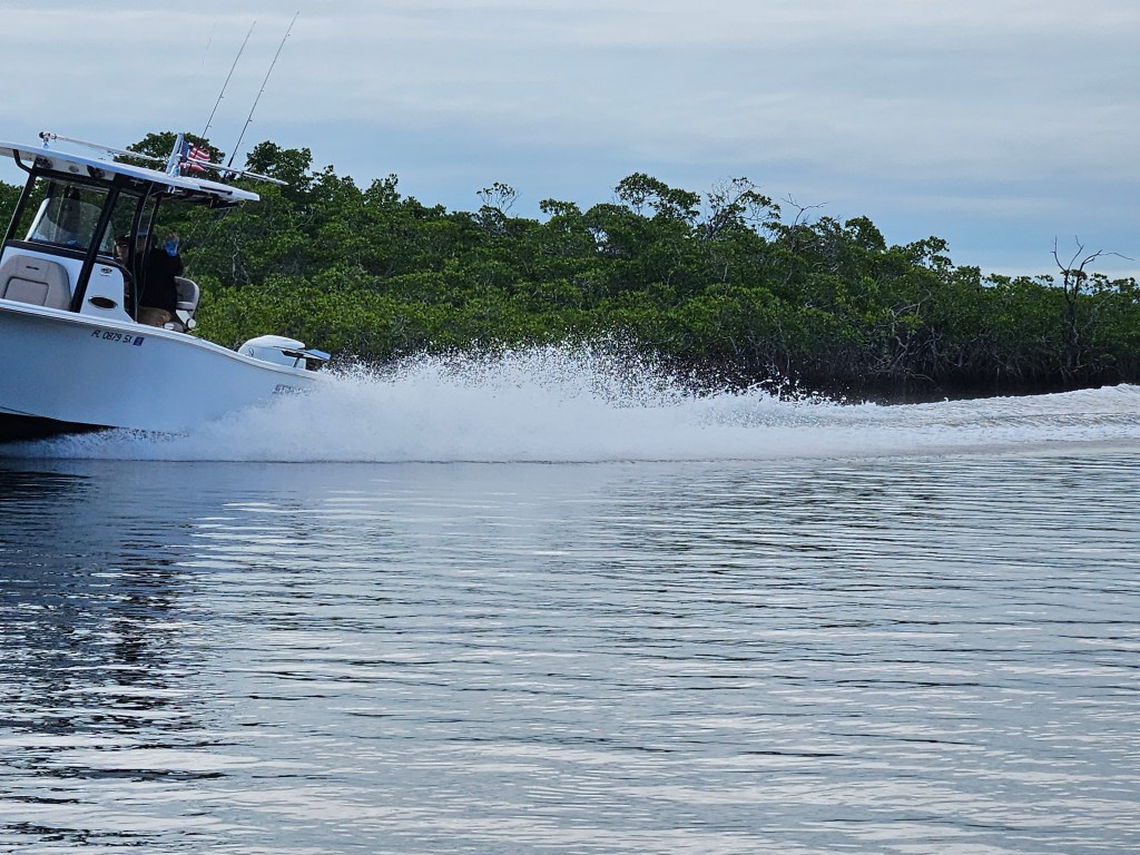
Idle speed limits are posted in certain areas, but after crossing those areas, some boasters open up their throttles. Having to deal with rough wakes in such a serene setting was a surprise.They can be dangerous, especially to canoeist.
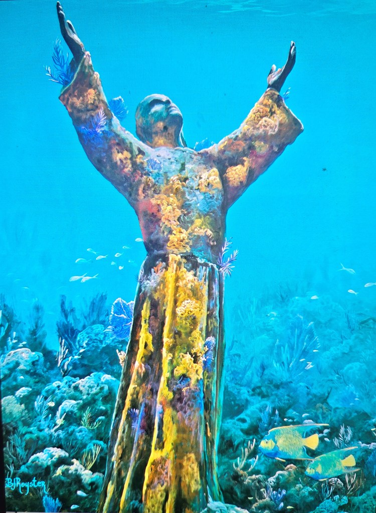
On Sunday, a few local residents soaked up some weekly rays on a short section of beach.A small marina provides a dingy landing and dockage for a few boats. It also acts as the headquarters for a local scuba diving operation that takes divers out to the reef.The original bronze 1800kg/2 ton, 3-metre/9- foothigh Christ of the Deep//Cristo degli Abissi, (1954), is located off the Italian Rivera in the Mediterranean Sea; a replica of the original is submerged off Grenada in the Caribbean. The 3rd statue cut from the original Italian mold, (above), was lowered into the sea in 1965, six miles off Key Largo’s shore. To ensure the statute stays in place during stormy weather, it sits on a base of layered concrete weighing 7258kg/16000 Ibs. It is a main diving and snorkeling attraction in the underwater park. The statutes are memorials to all those who have lost there lives at sea.
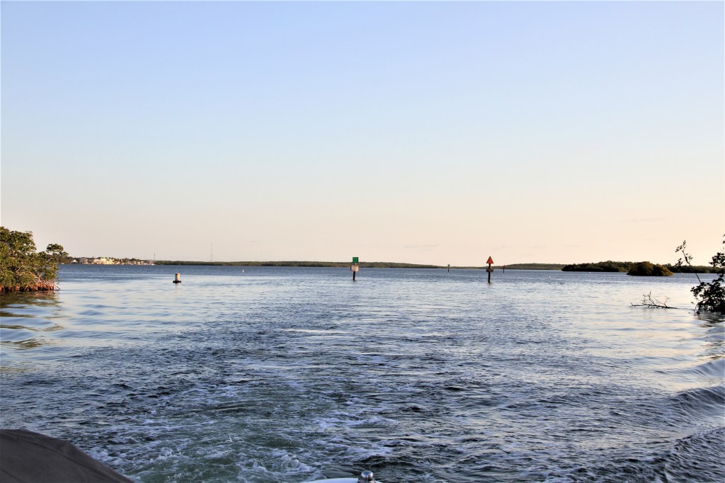
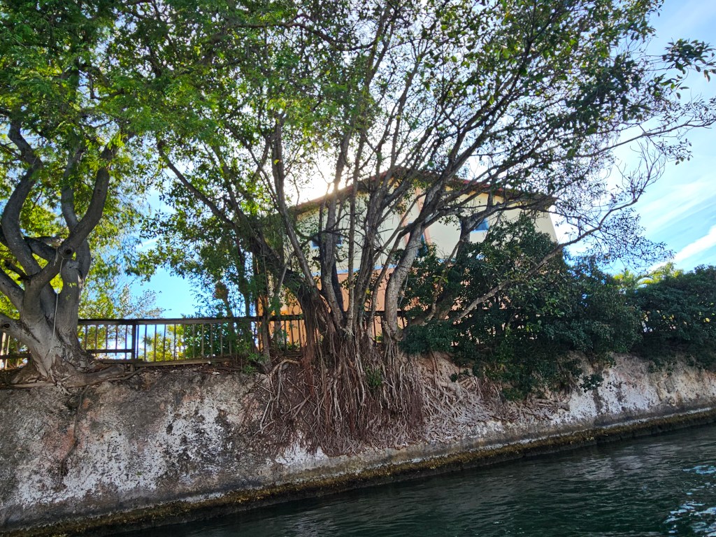
From the Sound, (Atlantic side of Key Largo), a channel, (Marvin Adams Waterway), cuts across the Key, (pictured above & below), to Black Water Sound, (a shallow bay lying east of mainland Florida ). The canal allows small boats to access Florida Bay, (west of Key Largo), and from there, the Gulf of Mexico. During certain tidal changes, water can rush through the channel like river rapids.
The canal, 1/2 mile long, saves about 30 minutes of travel time from having to go around the bottom of the key; not a significant savings; but Marvin Adams, the instigator of the canal, was a realtor with a focus on selling land.
Permits were easier to obtain in the ’50s and when the Army Corp of Engineers approved the project stating that the canal would offer more protection for boaters during storms, the plans proceeded.
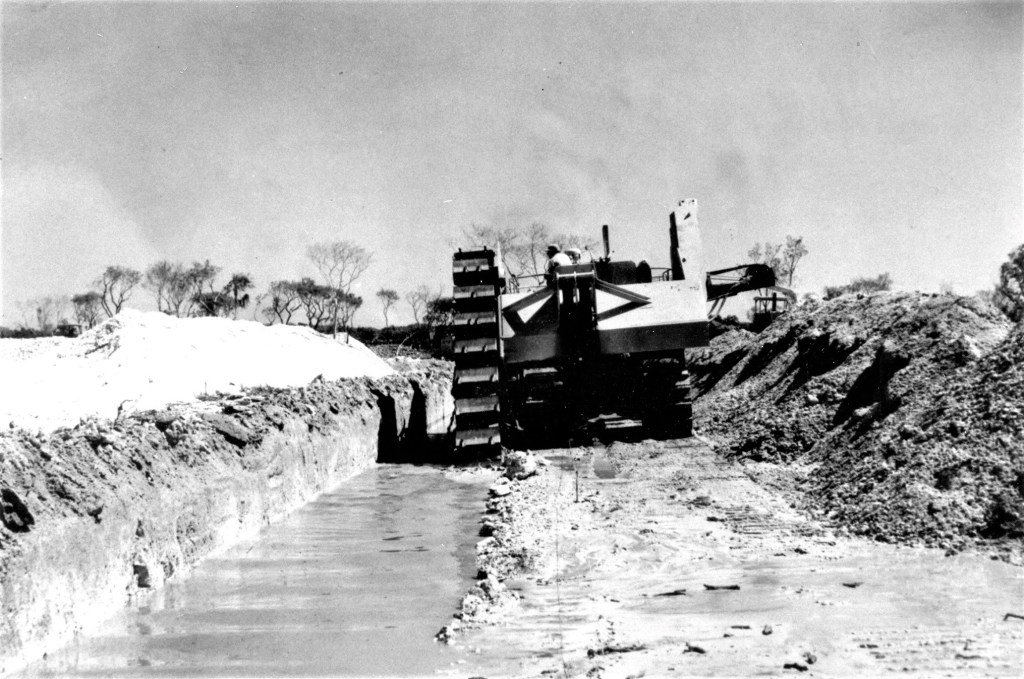
The cost to dig the canal in 1956, $690,000, was waved by the contractor in exchange for keeping the loose material; coral rock-fill was selling for approximately 1$ a cubic yard. Other expenses included engineering costs, building a bridge, and preparing supports for the pipeline that carries water from Florida City to the Keys. Marvin Adams personally funded those projects.
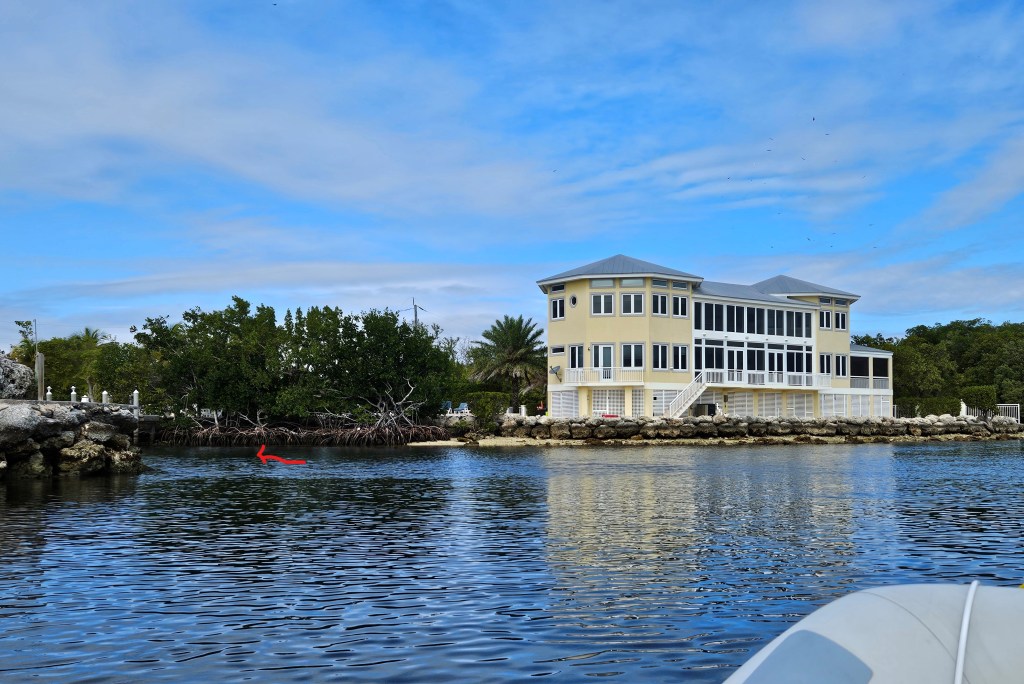
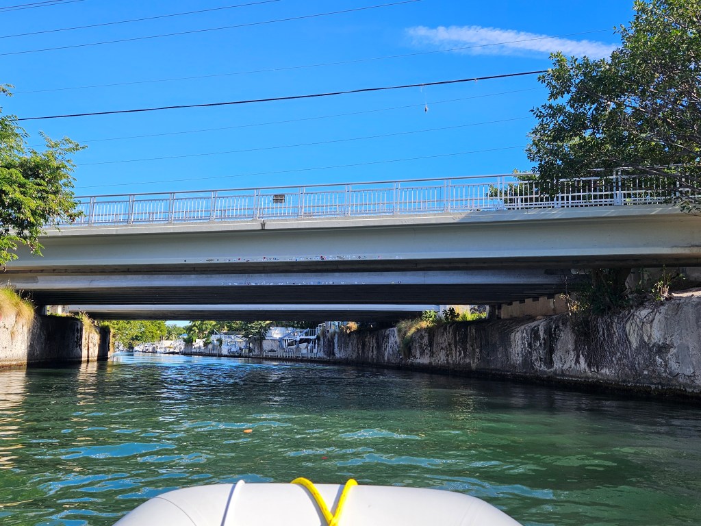
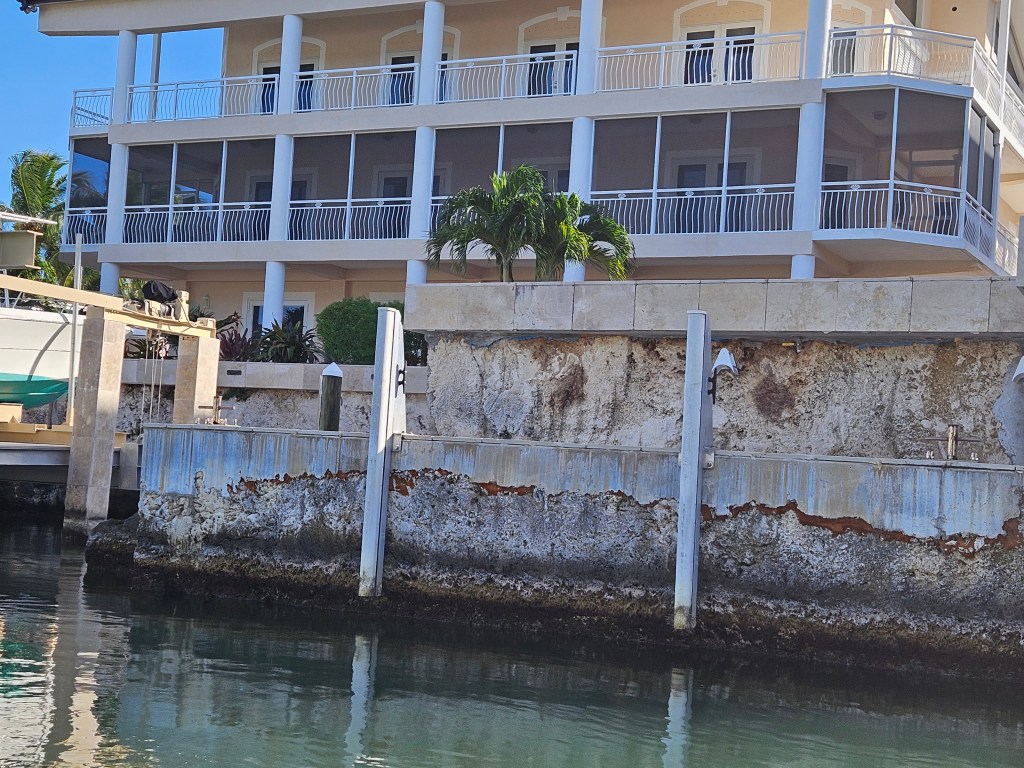
Creating the canal entailed digging 2 narrow trenches 30m/100 feet apart. Then the contractor dynamited the centre portion. The two end portions were left until the canal was finished, preventing water from flooding during construction. (Picture courtesy of the Historical Preservation Society of the Upper Keys.)Marvin Adams Waterway, (picture courtesy of Conley Sales Group.) This house, on the corner of the Sound and the channel, (red arrow), was for sale for $16,000,000. To view the house click here: https://www.zillow.com/homedetails/180-Pompano-Dr-Key-Largo-FL-33037/104214293_zpid/https://www.zillow.com/homedetails/180-We explored the canal by dinghy; the twin bridges seen above are Route 1, the highway connecting the Keys to Miami. The pipeline* also runs across the canal following the highway.
*Fresh water is pumped from a below-ground limestone wellfield located west of Florida City, 48km/30 mi away. Key West, (20km/126mi from the well), supplements their water with a desalination plant. Before the pipeline was installed in the 1940s, water in Key Largo was accessed from private cisterns and transported via barges and trucks.
*********************
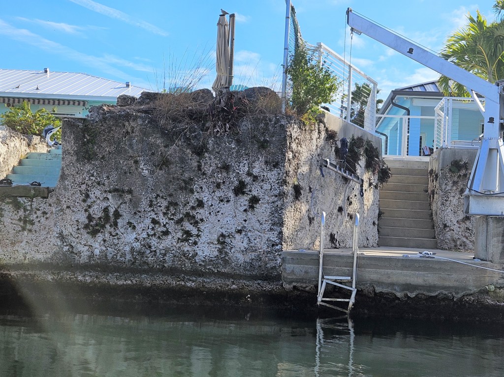
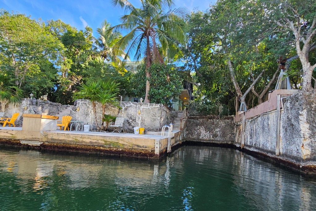
The sundeck and stairs to these canal homes, (pictured above), shows the depth of excavation needed to create the canal. In addition, the water depth is about 4.5m/15 ft. The stone is limestone, ancient fossilized coral-reef formations – the foundation of the Florida Keys.
The limestone sides of the canal are approximately 15-20 feet high.
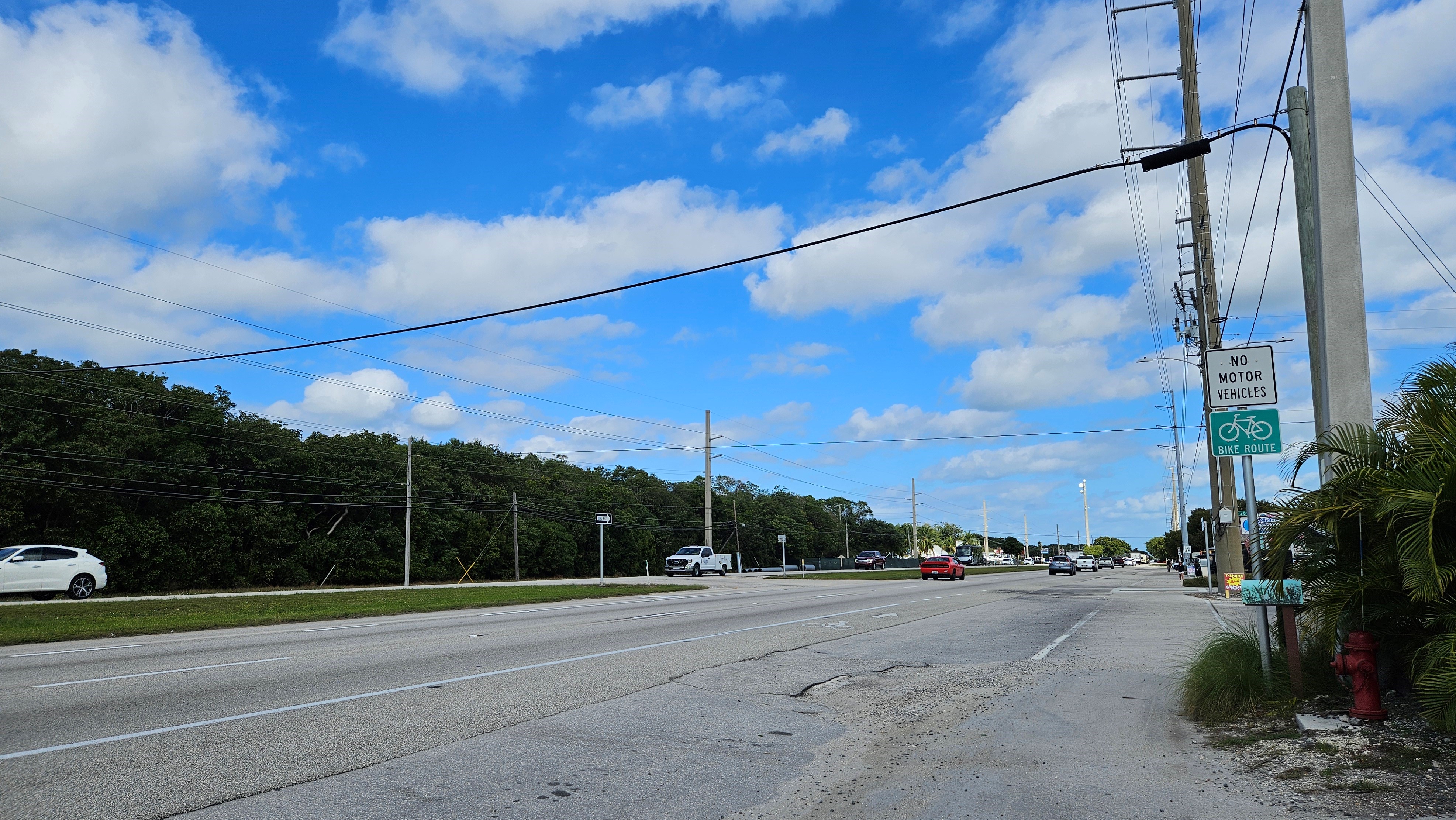
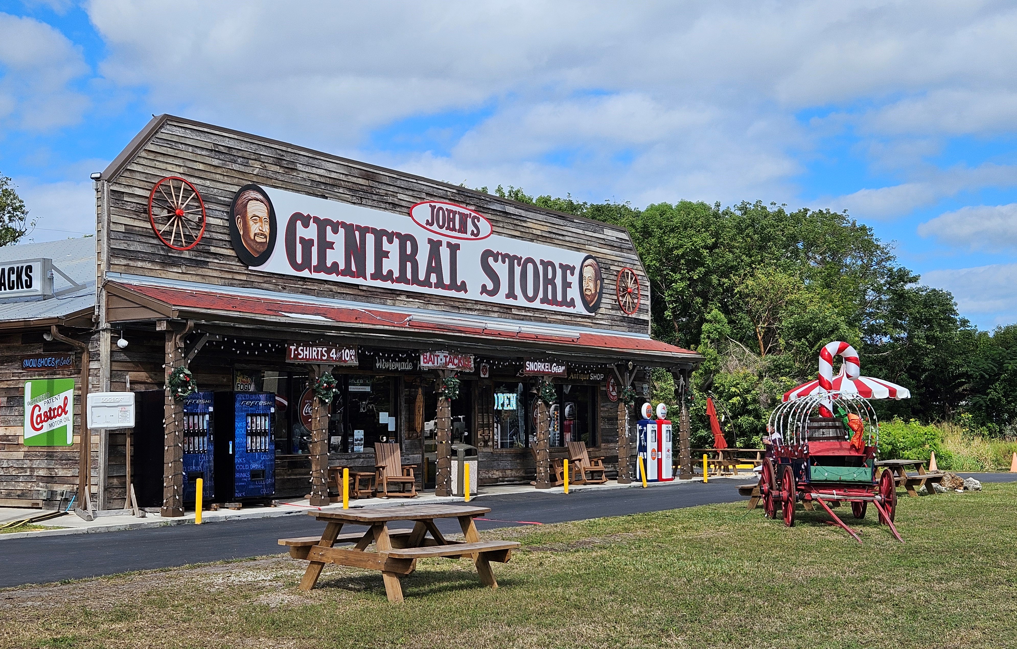
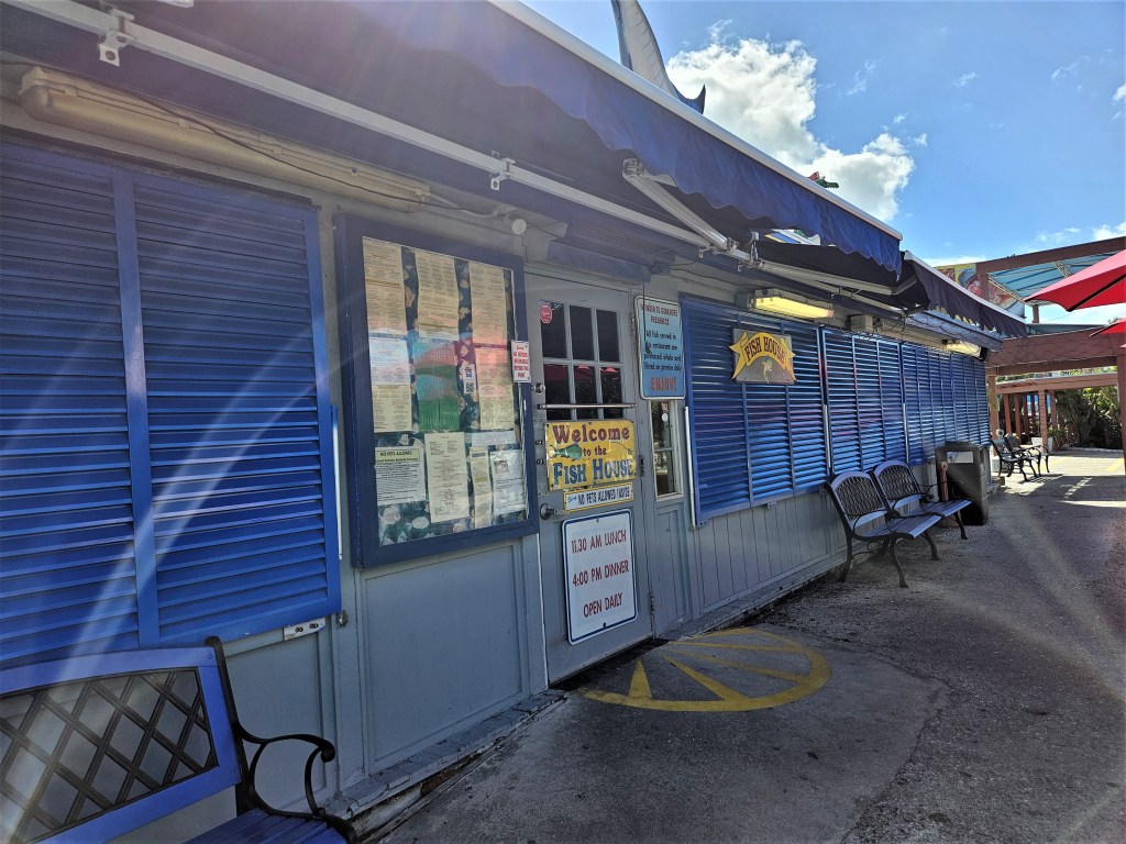
Searching for a restaurant called Fish House, we left the dingy at the marina and walked through the park to the highway.
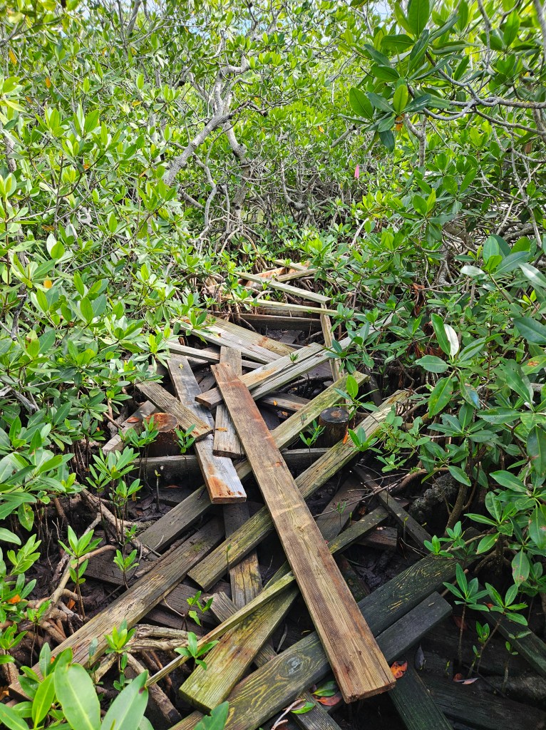
Certain boardwalks are still awaiting repair following storm flooding.Much stronger walkways constructed of manufactured wood-planks and metal railings are replacing traditional wooden boardwalks.
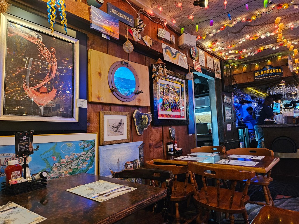
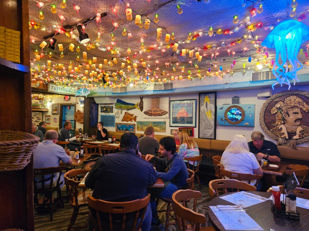
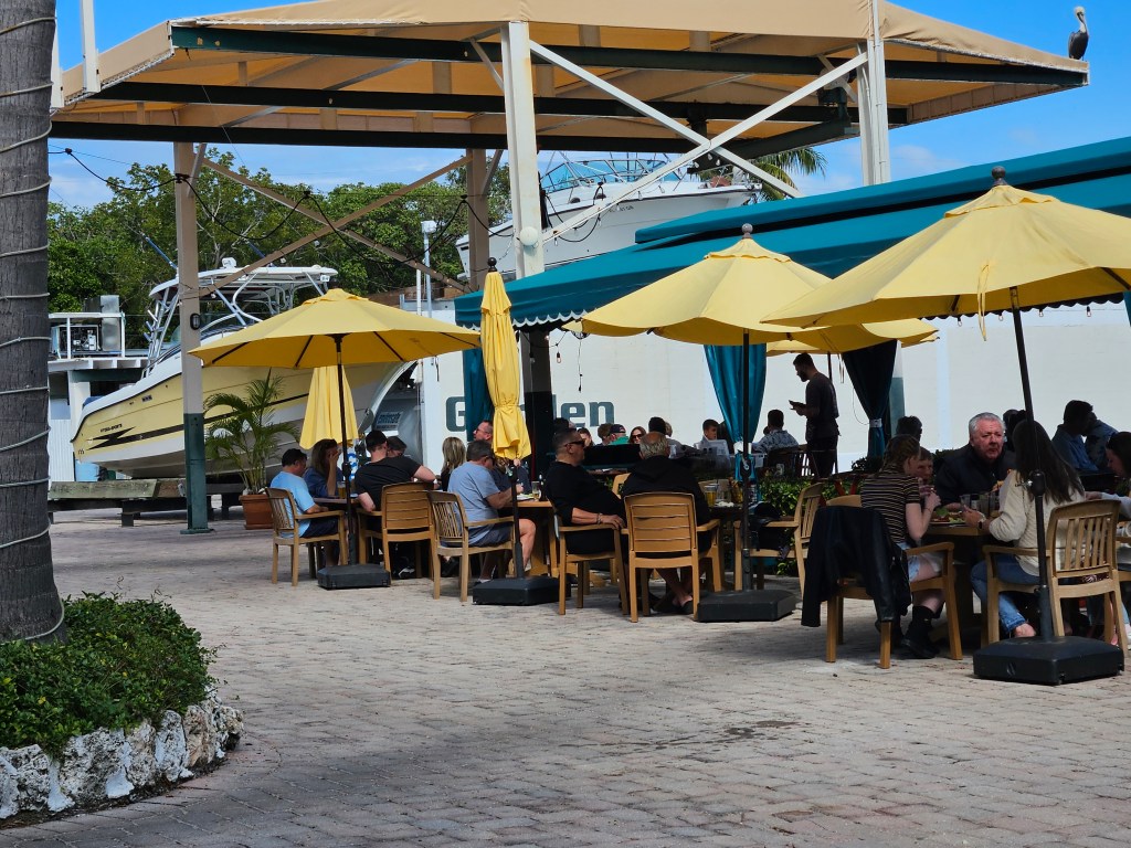
Fish House restaurant.
It was popular with the locals and it served well-prepared fish.We went there twice!
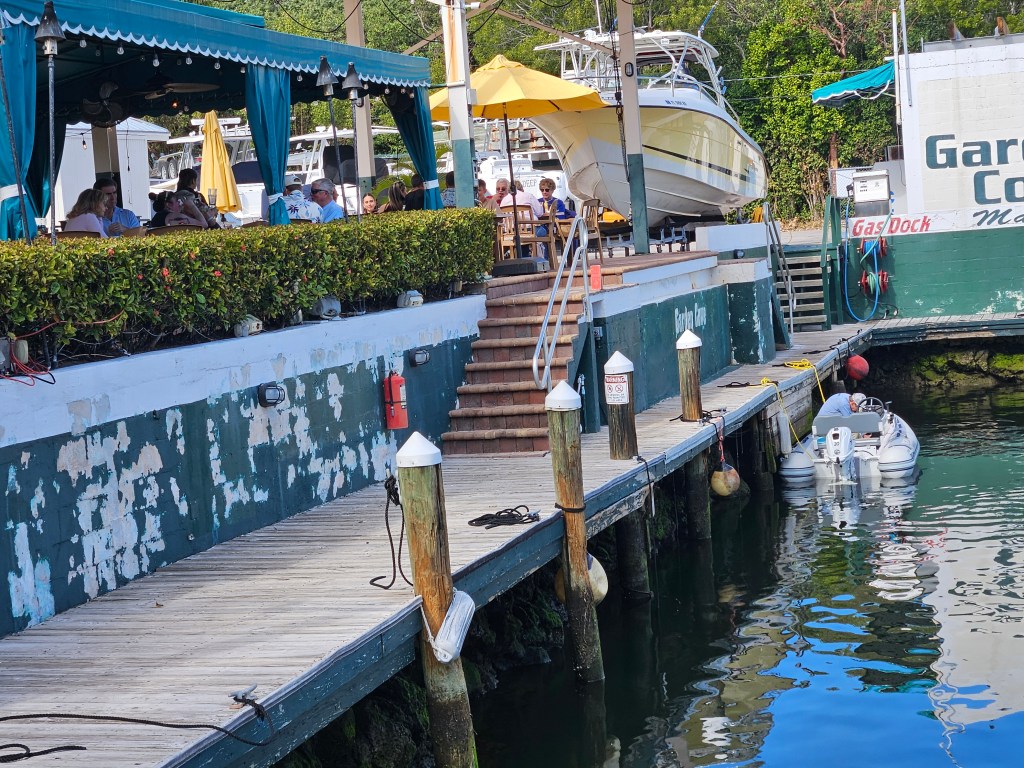
The Buzzards Roost, another recommended restaurant required a little more exploring to find it.
Driving the dinghy across the Sound, we turned onto more winding mangrove-lined waterways.
The Buzzards Roost restaurant.We tied our dinghy to their dock.The restaurant served good food.
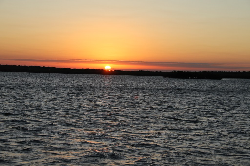
During our stay and while tied to the mooring ball, we enjoyed some nice sunsets.
2 responses to “Pennekamp Coral Reef State Park, Largo Sound, Key Largo, Florida”
serene42404a6f79
So much fun to read about your trip. My kind of restaurant that you went to twice. The wildlife is beautiful. I am fascinated by it as well as the local flowers, trees and bushes. Fun to read about the infrastructure along the waterfront.
Safe travels
Jean
Sent from my iPhone
Thank you Jean, We too love the outdoors. We wish we could do more anchoring on this trip . But if we want to learn about the area and meet the locals who live there, we need to go into dock most of the time.


Leave a comment